
April 9, 2025
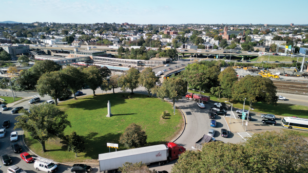
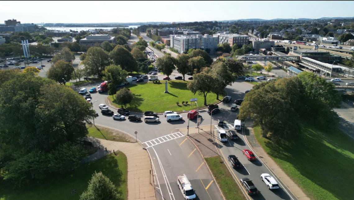
An overview of Kosciuszko Circle: Columbia Road is at top middle, the road to South Boston at right.
MassDOT photo
State highway officials convened a public meeting last week to discuss changes to the road system at Kosciuszko Circle (K-Circle), Columbia Road, and Interstate 93. About 40 people turned out for the in-person discussion at Boston College High School on Morrissey Boulevard.
After two years of internal study, officials from the Highway Division of the state’s Dept. of Transportation (MassDOT) say they have several engineering fixes in mind, but have not settled on a final proposal.
The rotary at K-Circle is one of the most notorious and dangerous traffic spots in the Commonwealth for vehicles, pedestrians, and bicyclists. According to MassDOT project manager Joe Breen, between 2017 and 2021, there were 299 crashes reported in the rotary and the nearby Columbia Road connection, one of them a fatality and 57 of them resulting in injuries.
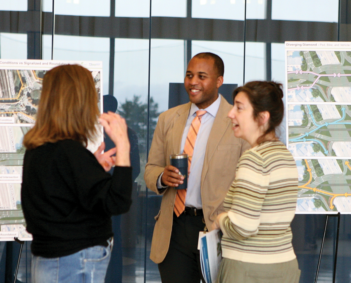
While MassDOT and its consultants unveiled some potential reconfigurations for both Columbia Road and K-Circle, they stressed that no single solution is set in stone and that no cost estimates have been made.
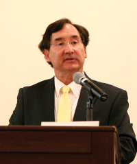
“We are in the infant stages of this design,” said Matthew Jasmin, a senior engineer consulting on the project for Howard Stein Hudson. “This isn’t it. We want to hear what you like and don’t like and how we can make it better.”
City Councillor John FitzGerald and Matt Moran, a planner for the Boston Transportation Department (BTD), both emphasized that public input would weigh heavily in the final plan.
“It’s not just two options,” said FitzGerald. “Going forward, this is an open forum for all ideas and MassDOT is open to hearing that. They want to give us something to chew on with this…I want to make sure people don’t feel pointed into a corner with these two options.”
Added Moran, “We want to make sure there are additional alternatives beyond these four explored. There are a myriad of options. We would like to look at all the options in a visioning session to make sure no stone is unturned.”
Still, MassDOT representatives and their consultants didn’t come empty-handed. Planners divided the corridor into two pieces— the first being the stretch of Columbia Road from JFK Station west to Buttonwood Street — and the second the K-Circle rotary.
For the Columbia Road section with its critical entry and exit ramps to and from I-93, two concepts of a Diverging Diamond Interchange and a Displaced Left Turn situation were unveiled. Both are drastically different than the current set-up and very uncommon in the Northeast.
The diamond model allows traffic on the main road to briefly cross over to the opposite side using special lanes, with the diamond shape reducing the numbers of signals and the need to turn left across oncoming traffic. The Displaced Left enhances traffic flow by re-routing left turn vehicles to a dedicated lane opposite the intersection and eliminating the need for left-turn lanes at the main intersection.
Breen mentioned that one of the first Divergent Diamonds is under construction now in Natick. “Education on these will be the challenge,” he said of both configurations. “They are new to Massachusetts.”
The first Kosciuszko Circle and Columbia Road planning meeting took place on Thursday evening in BC High’s Cadigan Hall. Prior to the meeting MassDOT planners and consultants, such as Matthew Jasmin (shown here) spoke with residents and stakeholders about the process and some initial ideas.
The options presented at the outset for the K-Circle Rotary include a regular signalized intersection, or a modern roundabout, which is similar to a rotary in that it is a circle, but it is much smaller and works via reduced speeds and no lane changes.
Combinations of the four ideas were presented as food for thought to start the process.
In the audience were several residents from Harbor Point and Columbia-Savin Hill along with representatives from the Corcoran Jennison Co., which owns the nearby Harbor Point housing complex and an office building abutting the circle.
Harbor Point’s Orlando Perilla asked officials to think more about Mt. Vernon Street in the plan, especially how accessibility issues will be woven between K-Circle, JFK-UMass MBTA station, and the street, which leads up to the UMass Boston campus and the Kennedy institutions.
“It’s very important to keep it in mind,” he said.
Miles Byrne of Corcoran Jennison said they would like the process to address having direct access to Day Boulevard from Mt. Vernon Street.
“We are in a very public dispute with Dorchester Bay City [the planned development at the Morrissey end of Mt. Vernon Street] for accessing Day Boulevard,” Byrne said. “We are going to be more vocal about it because it’s so obvious it will be problematic if we don’t have access.”
Alexander Kowalczyk, a member of the McCormack Civic Association and a resident of the Polish Triangle advocated for the modernized roundabout, but reiterated a priority of the neighborhood being access to the waterfront more easily and safely.
“Living on the other side of the highway, I think it would be nice to get to the beach without having to go through the MBTA property or without having to do gymnastics to cross the roadway,” he said.
He and state Sen. Nick Collins made a strong request that the “Kosciuszko” name – he was a military leader from Poland who fought for the colonists in the American Revolution – remain in place with the statuary.
“He’s a very important figure to the community,” noted Kowalczyk. “That was put there by the Polish Citizens Veterans Club and they have standing, but more than that, it’s green space,” added Collins.
Collins also advocated for looking into creatively financing the project and not just considering state and federal funds for a project that would likely be in the hundreds of millions.
He said the cost of K-Circle and the accompanying Morrissey Boulevard would likely exceed any funding caps, and he encouraged looking at tools like District Improvement Financing (DIFs) and other vehicles, given the vast amounts of development being proposed nearby.
The senator also noted that this process had been “bifurcated” from Morrissey Boulevard and the greater neighborhood, which he believed to be a problem.
That was a criticism aired by Savin Hill’s Don Walsh as well in his calls for a more comprehensive planning effort for the area.
Dorchester’s Jake Wachman and South Boston’s Kim Scully suggested that planners look more carefully at the data they were using to predict traffic flows and trips through the area in the future.
“I think that’s bad data,” said Wachman. “I don’t trust that. I don’t think you should, either. I think the bad data is likely to result in bad designs.”
Meanwhile, Savin Hill’s Marta Carney cautioned against overdoing the designs, saying the circle isn’t gridlocked at all times, but really only on peak times. “It’s not a continuum all day long,” she said. “We might be alarmists here.”
Breen said they would be refining their alternatives, reviewing public comments, and coordinating with other partners following the meeting. A second one is planned for late spring or summer.
For more details about this project, follow the Reporter on Instagram, @dorchesterreporter.
Villages:
Topics:

