January 25, 2024
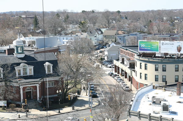
A view of Norfolk Street and the Great Hall in Codman Square as seen from the steeple of the Second Church of Dorchester in April 2023. Seth Daniel photo
The Mayor’s Office and the Boston Planning and Development Agency (BPDA) are in the early stages of making major changes to how development is planned and executed in and around business districts, with Dorchester’s Codman Square and Fields Corner designated to test the concept.
From eliminating parking requirements altogether to streamlining permissible commercial uses to designing open space, residents essentially will be deciding how their future neighborhood will look like and function as a community.
Dubbed ‘Squares + Streets,’ the process looks to “create a new toolbox” for planning and zoning by using five or six distinct zones that planners believe can speed up and simplify residential and commercial development.
“We are creating the toolbox right now that can be used, and in each mapping process (like Codman Square and Fields Corner), the community will decide what tools it wants to use,” said Aimee Chambers, a BPDA planning director. “It’s a very different way to approach planning and zoning than we have had in the past. It’s not unique nationwide in how zoning might work in other municipalities, but certainly it’s new to Boston.”
The task is daunting, and the subject matter often a bit dry, even confusing, but the result could make a major difference in how neighborhoods change – the types of businesses, the heights of buildings, and the parking restrictions that will be put in place over the next five years.
Right now, public engagement on the broader “toolbox” plan is underway, with a comment period ending this coming Sunday.
Chambers said they expect to bring the broader plan – known officially as a text amendment to the zoning code - before the BPDA board in February, with a review by the Zoning Commission expected in March.
Areas in Hyde Park and Roslindale will begin the more focused “map amendment” planning process in February – basically applying or not applying the tools in the toolbox to those specific areas. Codman Square and Fields Corner will go through that same process this spring, Chambers said.
Outside of this process, but very much connected to it, is Mattapan Squares + Streets that is being mapped now as part of the separate PLAN Mattapan effort.
Taking a wait-and-see approach, civic associations in Codman Square and Fields Corner deferred on commenting about the planning exercise at this point.
But at the Codman Square Neighborhood Council meeting this month, a presentation by the BPDA did raise the eyebrows of some commercial landlords who were wary about allowing the public to choose what tenants were preferred. Some worried they would lose control of whom they were allowed to lease to, and what businesses uses would be allowed or prohibited.
Already controversial is the idea of not requiring parking in any of the five zones – known as S0, S1, S2, S3, and S4 – for new developments. Currently, minimum parking requirements are in effect for all developments, and those requirements are often matters of contention during community reviews. This new process would eliminate those arguments by not having any requirements, but it has brought on concerns about how such a change could affect parking availability.
“In zones S0-S5 there is no minimum parking requirement,” said Chambers. “That doesn’t preclude a developer from offering that as an option in their project…Many are concerned about residential parking, and we’ve had a lot of concern about commercial parking. We’re really trying to be thoughtful in bringing on a transportation consultant to work with us through the parking process.”
Chambers said the reason for eliminating the parking requirement is that the new zoning initiative looks to accelerate housing development as a key priority. She said building out parking is “one of the biggest barriers to affordability in development” and “can make or break a project.”
Included in that discussion will be the topic of establishing loading zones in commercial districts to prevent double parking or inappropriate truck parking for deliveries, she noted.
Less controversial is the reconfiguration of the “table of uses,” or what is allowed in each district. Chambers said the city’s table was found to be convoluted and, in some cases, repetitive for businesses looking for licenses. By simplifying or combining uses, they have whittled the proposed table down from 250 to 90 categories.
“One thing that jumped out is that we get a lot of requests to review applications for take-out [at restaurants] because it’s a stand-alone use,” she said. “Even if you’re an existing restaurant, you have a separate approval process to get take-out allowed. Nine out of ten times there was no reason to object to that.”
She also said there was a special review process for ice cream stores, which probably isn’t necessary. “It’s something we don’t need to be as strict on as we are,” she said.
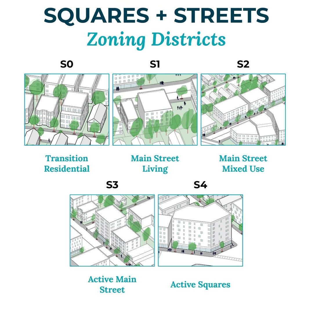
The breakdown of the five zones include the following:
•S0 – Transitional Residential areas that are often around the corner from business districts and would promote development of 6-to-14-unit buildings that are now considered non-conforming.
•S1 – Described as the Main Street Living district with larger buildings that don’t contain commercial uses but have open space.
•S2 – A Main Street mixed use district with larger buildings that can have commercial uses on the ground floor and some open space.
•S3 –Active Main Street area contemplates dense housing with smaller setbacks, less open space, and required ground floor commercial space.
•S4 –Active Squares district that contemplates up to 7 stories or 85-foot-tall buildings with required ground floor commercial, open space as amenities like roof decks, and most uses – except lab uses – are allowed.
•S5 – A high-density S5 district had been on the table originally but has been pulled back for re-thinking. That district was only to be used sparingly but would give the plan the ability to have buildings of around 13-to-16-stories tall. This district is currently not part of the plan, but could be re-inserted during the approval process, Chambers said.