September 7, 2023

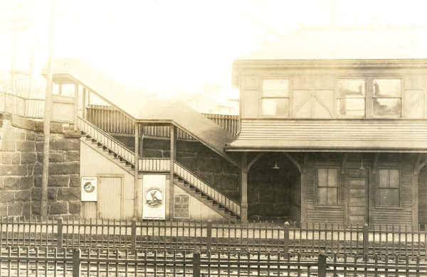
Savin Hill train station in November 1924. Courtesy city of Boston archives
From the ferries and stagecoaches of the 19th century to the trains, buses, and trolleys of today, Greater Bostonians have used public transit to make their way around the region. With routes planned out 150 years ago still in use, the city’s neighborhoods are living with the shape of its transit system, albeit slowly these days due to underinvestment spanning decades.
Today’s Dorchester has the Red Line and the trolley line that goes on to Mattapan Square after a dip into neighboring Milton running through it, but it was the streetcars of yesteryear that re-shaped what was a mostly pastoral setting right up to the dawn of the 20th century.
“Dorchester is one of the great examples of an urban neighborhood that was built by streetcar service,” said Garrett Dash Nelson, the president and head curator of the Leventhal Map and Education Center at the Boston Public Library. “Its transformation from an agricultural community to urban residential community was almost entirely a function of the expansion of the streetcar network.”
The public will get a chance to study the transformation through the cartography inside Nelson’s center at the BPL’s Copley Square branch. A free exhibit, “Getting Around Town,” will open this Saturday, Sept. 9, and run through April.
The exhibit is being guest-curated by architect Steven Beaucher, who authored the book “Boston in Transit” and owns WardMaps LLC in Cambridge, a store that sells antique and vintage maps. The exhibit will feature maps from Beaucher’s collections along with ones from the Leventhal Center and the Boston Public Library system.
“Understanding the degree to which Boston has a transit system that evolved over many centuries is really important to understanding how we live today,” said Nelson.
One of the takeaways for Nelson, a regular Orange Line rider, is how uneven public transit is throughout the metropolitan region, due either capricious choices made long ago or historical chance as time went by. Some parts of Greater Boston are well-covered by public transit while others are left to go without, and that map overlaps with socioeconomic patterns, with poorer communities facing longer commuting times.
The surface railways that built urban/residential Dorchester, and traversed its main arteries (Dorchester Ave., Washington Street, Blue Hill Ave, Columbia Road, etc.) are almost completely gone, with some of the routes now covered by buses. The streetcars, privately owned, were unprofitable through most of their history before the companies began experimenting with motor buses.
“When you look at some of the early twentieth century maps, you see how the city was interconnected and how people in neighborhoods like Dorchester would almost all have been living in close distance to a street railway or a heavy railway,” Nelson said. “That’s pretty different from today where we have a network of buses that feed rapid transit lines that are mostly focused on getting people downtown to downtown jobs.”
Up to the 1920s, said Nelson, “The map of a public transit system in Dorchester was the map of how almost everybody was getting around. “There wasn’t any other option, other than your feet.”
The rapid shift to mass automobile ownership at that time changed things, according to Nelson. With public transit a collection of disparate companies, chief among them the Boston Elevated Railway, state officials moved to organize all entities under a single agency by buying the companies and, in 1947, setting up the Metropolitan Transit Authority (MTA), now the Metropolitan Bay Transit Authority (MBTA), often referred to as the T.
But with state control came customer service cutbacks driven by the lack of profitability. In today’s Boston, there are only a handful of areas where public transit is the dominant form of commuting.
“When we think about why the system’s expansion and even its state of good repair slowed down in the late 20th century, you have to look at questions of who has power, who is being represented in the political system, who has money,” he said.
Those are all questions that people who step into the Leventhal Center can weigh. “We want visitors to come away thinking about the present and future and understand the historical shape of what happened,” Nelson said.
More information on the exhibit is available at leventhalmap.org.


