December 19, 2019
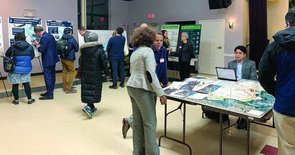
Attendees check out the informational tables at last week’s session in Fields Corner. Katie Trojano photo
The city’s initiative to prepare for the long term impacts of climate change returned to Dorchester with a second meeting at VietAid in Fields Corner last Thursday, drawing about 50 participants to the interactive event.
Feedback gathered at a September open house in Neponset informed more comprehensive design options for each coastal neighborhood that take aim at near-term and long-term strategies to reduce Dorchester’s coastal flooding threat.
“We’ve seen all along how important it is to get input from the community,” said Carl Spector, commissioner of the City’s Environment Commission. “It helps our understanding of the risks, the sites that are important to you, the uses of the environment. We’ve taken your feedback on the solutions and options that we’re starting to develop to protect the community.”
Spector advised attendees to “visit all of the tables, give a lot of feedback, and ask a lot of questions,” of the various agencies that have been involved in designing climate resiliency options, namely contractors from SCAPE, TetraTech, and others.
Pippa Brashear, planning principal at SCAPE, went through Climate Ready Dorchester’s objectives and explained risks that the community faces from rising sea levels.
“We are about two-thirds of the way through the planning process,” explained Brashear. “Since September we’ve taken the community’s ideas and synthesized them into the strategies that you’ll see here today. It’s with your feedback on strategies that we’ll be working with the city to craft final recommendations for a resilience plan.”
Brashear said that much of the feedback gathered from the community has shown concerns over a disconnected waterfront – oftentimes including large chunks of open space – that aren’t easily accessible and often experience flooding. Homes, businesses, community assets, and critical lines of transportation infrastructure that serve both Dorchester and parts of the greater region are also at risk of serious damage due to climate change.
“Flooding happens in two types of ways in Dorchester,” Brashear pointed out. “One is in the low-lying areas along the waterfront, areas like Harbor Point or Port Norfolk that experience intense storms. There are other areas, in places that are more inland, where there are flood pathways. We see that in stretches of Morrissey Boulevard and in Clam Point. So we’ll be looking at all of that.”
She explained that the coastal risk facing Dorchester comes in three parts: sea level-rise, which is slow and permanent; storm surge, which is event based; and wave action and erosion, which accompanies sea level-rise and storm surges, and is both slow and permanent and event based.
“We really want to develop neighborhood-specific strategies that reflect the diversity and vibrancy of the physical parts of Dorchester, but also the people that live here,” said Brashear. “Some of the goals that we’ve heard are to enhance access and mobility, promote the health and values of the ecosystem particularly along the Neponset River, and invigorate the waterfront.”
She added that the city is taking into account how planning for climate resiliency will affect the future, specifically how new development in the area could do so.
Community-specific planning design alternatives were split between Dorchester neighborhoods: Lower Mills, Neponset Circle, Port Norfolk, Victory Park to Tenean Beach, and Morrissey Boulevard to Columbia Point. Residents were invited to look over the two or three designs for each neighborhood and then vote on which design seemed most appealing.
Options for Morrissey Boulevard included raising the boulevard itself, a plan already in design phase through the state’s Department of Conservation and Recreation. Port Norfolk could see the implementation of a layered approach that would elevate roads, open spaces, and adapt buildings; or a perimeter approach that would include a raised Harborwalk and a berm to protect against high tide events.
Proposed designs for Lower Mills included raising railway beds and using berms. Options in the Neponset Circle area showed a completely revised Harborwalk, widening and elevating the pathway.
From Victory Park to Tenean Beach, options included a deployable flood barrier at Conley Street and a flood wall along a rail, or a berm along Tenean Beach.
Despo Thoma, project manager and senior designer at SCAPE, answered questions from open house attendees, explaining the specifics of how various designs would work. “Based on the conversations today, with some additional stakeholder feedback, and working with the city, we’re trying to finalize the preliminary designs for the new year,” Thoma told the Reporter.