
May 1, 2024
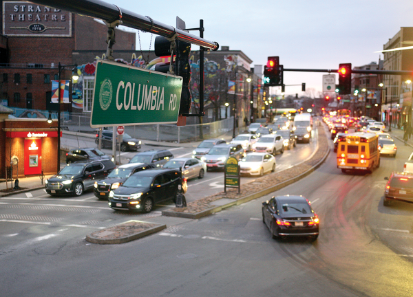
A view of Columbia Road in Uphams Corner. Seth Daniel photo
City officials are gearing up to redesign a 2.4 mile stretch of Columbia Road from Kosciuszko Circle to Franklin Park and they say they want the communities along the corridor to be front and center when questions like “bus lane or not?” are being considered.
The conceptual design for the roadway, which Boston Transportation Department (BTD) leaders describe as a “pseudo-highway,” calls for more of a tree-lined road with an emphasis on serving those who use the bus.
“Center running or any such dedicated bus lane is on the table if the community wants that,” said BTD Project Manager Xavier Lopez.
Vineet Gupta, the agency’s director of Transportation Policy, emphasized that a push for any sort of bus lanes – as were introduced in the Blue Hill Avenue redesign this year during a controversial, years-long discussion – would have to come from the community. The city, he said, would not be pressing for them.
“The answer to that is we don’t know yet,” Gupta said. “We want to make sure it’s a collective decision between the city and the community as we move forward. While we wouldn’t yet rule out center-running bus lanes or any bus lanes, we’ll let the community decide and if there is an appetite for that, we would consider it. We’re not necessarily parachuting in with our own agenda on how Columbia Road looks five years from now.”
The budget for the design work is at $11 million right now, and once a design is finalized next year, the city will come up with a funding strategy that would likely use city, state, and federal resources, he said.
What is known is that in any redesign, a rehabilitated Columbia Road will have less of an emphasis on private vehicles and more of a focus on riders using bus routes 16, 17, and 41, cyclists, and pedestrians.
“Columbia Road now lends itself to private vehicle travel and not cyclists or people taking the 16 bus or even pedestrians walking. It isn’t safe for those choosing other modes of transportation,” said Lopez.
“There are 6,000 people per day using Route 16…and it will be a new high-frequency route with buses coming every 15 minutes or less seven days a week,” he noted. “We want to keep these people taking the bus in mind.”
Also on the to-do list: shorter distances for crosswalks and a substantial tree canopy so that the entire stretch is more green and less concrete.
“Really, we see this as a major tree-lined corridor street and a front yard for folks that live along the corridor,” said Lopez.
City Councillor Brian Worrell said he supports the investment and will be monitoring the process to see what the final design includes.
“A redesign and increased investment in Columbia Road are long overdue and I hope the designs ultimately center what residents have long called for, including pedestrian safety measures, beautification of the corridor, and increased tree canopy,” he said. “We need to redesign our streets to slow down our cars and make sure everyone using our streets is safe.”
The Toole Design Group has won the contract as lead planning and design firm. Livable Streets Alliance will conduct the engagement process, along with partners like Dorchester Bay Economic Development Corporation, DS4SI of Uphams Corner, and Greyscale Collaborative. The local artist Jaypix Belmer will be a photographer for the effort.
As to a timeline, project partners will be ramping up through the rest of this year, with design efforts in full swing in the fall and wrapping up in the spring. However, like Blue Hill Avenue’s improvement strategy, there will be short-term fixes that will start in late summer and early fall, Gupta said. They will include fixing potholes and crosswalks, targeted street repairs, sidewalk improvements, and streetlight maintenance.
An early action “tactical urbanism” project, likely some sort of art feature, will be community-led and will also come in the late summer or early fall.

